Maps Unfolded | Students Discover Hidden Treasures
Exhibition Maps Unfolded - From Atlas to Streetmap (3): Collections for Education
4 May 2023
As part of the University Library, Allard Pierson's task is to collect, manage, unlock, research and present the cultural heritage of the UvA. Almost every day, Allard Pierson is open to students and researchers to consult materials for their research. But also for the general public to be taken along by the museum full of objects. Most people know the museum functions and academic character. That Allard Pierson also makes the collections accessible to primary and secondary education is not known to everyone.
Educational programming
Olav van den Berkel, educator at Allard Pierson, worked for almost a year on the educational program for the Open Map exhibition. He explains: “As an educator, I am constantly looking for the connection between old and new worlds. How do you make cultural-historical exhibitions relevant to students from primary and secondary education? I do this together with colleagues and external parties. In doing so, we make crossovers between, for example, geography, history, art, and culture. We relate to current issues and involve the living worlds of primary and secondary school students."
The UvA has countless hidden and visible treasures with Allard Pierson. These treasures, and the stories they carry with them, are undoubtedly of great value to children.Olav van den Berkel, educator at Allard Pierson, part of the University Library
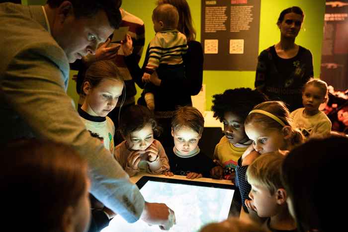
Primary education
The Allard Pierson offers an interactive education program for students in groups 6, 7 and 8 of primary education. Under the guidance of a museum teacher, they travel around the world in the Open Map exhibition, where they get to know numerous special maps from the past and present. For example, they reflect on themes such as war and conflict, slavery and climate change, and discuss various dilemmas. Historical maps and atlases are beautiful to look at and give us insight into topography and history. But what stories are hidden behind the maps? From positive and less positive stories, Allard Pierson plays 'open map'.
The collaboration with Amnesty International and Noordhoff adds an extra dimension to the educational programming. Very special.Olav van den Berkel, educator Allard Pierson, part of the University Library
After the tour, an inspiring workshop follows that has been developed in collaboration with Amnesty International. The link with current events is made here. How did our ancestors treat each other and the earth? What would we do differently? The same? The students discuss and reflect on their own ideal world. Finally, the students write the "Save the World" rap that they perform under the direction of theater maker and teacher Reno van Rijsewijk.
Secondary Education
For secondary education, the Allard Pierson has developed an interactive program in collaboration with Noordhoff and Fleur Knops, educator at Radius - Delft and Boijmans van Beuningen. In this program, high school students are introduced to ancient maps of the Netherlands and the world, as well as the latest technological developments in cartography. Old and current maps and atlases display an ever-changing world. Borders are redrawn time and again by both people and nature. Maps show the past, sometimes with harsh realities, and are used to contemplate the future. In the exhibition, students discover the layers of maps; what beautiful and less beautiful stories are hidden behind the often beautifully designed maps?
After the expedition, the Allard Pierson shows some film footage, in which students get to know the 'Nordsjøen dike', a dike designed by the Dutch oceanographer Sjoerd Groeskamp. This dike protects our country against the rising water. Each student then visualizes the future of the Netherlands in an infographic. Finally, in the Geozone, students are presented with thought-provoking statements about digital Bosatlaskaarten and discuss them under the guidance of a museum educator.
The exhibition Open kaart – van atlas tot streetmap and the educational side programs can be enjoyed until 20 August 2023. Visit now!